San Diego County, California
Project Highlights
- Drone Operations
- Brush Management Monitoring
- Work-boundary Delimitation
- Avoidance, Minimization, and Documentation of Sensitive Species
- Environmental Training
- Project Management Support: Logistics and Coordination, Safety and Compliance Measures
Artemis Environmental has teamed with AECOM to support a large local utility and their Wildfire Fuels Management Program which selectively minimizes wildfire fuel loads in high-risk fire areas within utility right-of-ways. Artemis Environmental biologists lead vegetation treatment crews to work areas, perform wildlife clearance surveys and site assessments, define work plans and delimit work areas for each site, provide oversight and guidance to the crews including as-needed environmental trainings, verify implementation of safety and compliance measures, avoid sensitive vegetation and wildlife, and complete electronic, client-ready reports documenting each site before and after treatment. Artemis biologists were also involved with a PR program documenting the project in action by providing content in front and behind the camera, as well as drone operations.
Artemis retains biologists that are certified under FAA Part 107 for Commercial UAS operations and can perform various functions of a flight operation from remote pilot-in-command to visual observer. Along with experience in consumer-grade drones capable of providing high-resolution aerial photographs, staff have direct experience flying commercial-grade systems such as the state-of-the-art, American-made Freefly Systems’ Astro drone. This drone features real time kinematic positioning (RTK) and 61-megapixel camera, capable of providing numerous aerial sensing options, including very high-resolution 3-D imagery. This includes work on the Wildfire Fuels Management Project, where this drone was used to track the minor changes in native vegetation density before and after treatment.


 Tara and Julie have been teaming up since 2016, when Julie first started Artemis and Tara was working as an independent biologist. A joy to work with, Julie quickly grew to become one of Tara’s favorite clients. As Artemis grew and Julie’s needs for full-time staff did too, it made for an easy decision and an exciting opportunity for Tara to officially join Artemis in 2019 and help grow a small, woman-owned business.
 Steve Till received a B.S. in Botany from Northern Arizona University and has worked exclusively in the field for over 20 years throughout the west, from low deserts to high mountains. After spending years eradicating tamarisk from the Grand Canyon, Steve moved on to lead crews on botanical inventories and monitoring of the national parks of the southwest. He has been doing both rare plant and weed surveys in many states for over a decade, and is always excited to learn the flora of the new regions that his work takes him. Steve has filled gaps between the botanical seasons with other biological work, including desert tortoise surveys, native fish restoration, and nesting bird surveys. He enjoys the ever-changing nature of science related work, the talented and inspiring co-workers, the abundance of scenic landscapes, and hopes to continue field work in the American southwest for many years to come.
 Born and raised in San Diego, Monica Tydlaska’s passion for environmental conservation has led her all over the state of California in pursuit of fulfilling work and her education. Monica received her B.S. and B.A. from the University of California – Santa Cruz and M.S. from San Diego State University in Biology. Her thesis focused on visitor knowledge and activities on rocky intertidal stores. Monica even lived for several years on the Santa Catalina Island, managing plant conservation and restoration projects for the Santa Catalina Island Conservancy.
 Olivia Arredondo is an Associate Biologist with experience in limnology and stormwater monitoring. She has a B.S. in Ecology and Evolutionary Biology from the University of California – Santa Cruz. In 2020, she moved to Southern California from the Central Coast to work with the California Department of Fish and Wildlife where she monitored the federally endangered Southern California steelhead trout. Her work also included habitat and barrier assessments, snorkel surveys, and rescues and relocation following Southern California wildfires. Olivia has worked on various projects for the Elkhorn Slough National Estuarine Research Reserve and the Santa Clara Valley Water District conducting water quality monitoring, comparative food web studies, mercury monitoring, and vegetation surveys.
 Find Natasha on the trail, stargazing, or in the garden, with family. She is passionate about the environment, conservation, and community service. One of her favorite quotes, “We do not inherit the earth from our ancestors; we borrow it from our children”, sums up her views of conservation and sustainability and her desire to preserve Earth’s natural wonders for future generations. During her free time, Natasha volunteers with cubscouts, encouraging and teaching youth to explore the outdoors safely and with a conservation mindset. Ultimately, Natasha hopes to inspire and grow a passion for the wilds within our youth that will translate into action.
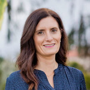
 Margie Mulligan is a botanist that specializes in the flora of San Diego County and cross border plants in northern Baja California. She has almost 25 years experience working in Botany with over 15 years in southern California. She has worked for the National Park Service, Forest Service, The Nature Conservancy and the San Diego Natural History Museum. Her experience includes floristic surveys, rare plant monitoring and surveys, vegetation community sampling, vegetation mapping, Quino checkerspot butterfly surveys, using taxonomic keys, technical writing and data management. Her recent focus is on the genetics and monitoring of endangered and federally-listed plant species in Southern California. She is on the board for Southern California Botanists, San Diego Botanical Society and the California Native Plant Society Rare Plant Program. She is also an adjunct professor at San Diego State University and co-teaches the course, Field Botany of San Diego.
 While driving around town, Julie’s dad would sometimes say, “Hey girls, our trucks were used to build that project.” With the same pride, Julie has caught herself saying, “Hey boys, we are working on that project.” Helping clients build a better, healthier world is in Julie’s blood. Ms. Ogilvie is passionate about supporting projects that help to improve lives while protecting our natural resources. As a California-licensed attorney with a Master’s in Ecology and knack for finance, she is uniquely suited to aid clients on a wide range of matters. Ms. Ogilvie has more than 15 years of experience supporting a diverse array of clients and industries, including energy, utilities, transportation, water, wastewater, private development, government and the military. She brings “big firm” competence to the personalized, boutique service she provides at Artemis.
 For as long as she can remember, Chelita has had a strong pull toward needing to protect the earth’s environmental resources and biodiversity. Before starting at a university, she already knew exactly what she planned to study: environmental studies! While in college, she had the opportunity to participate in environmental work in Tijuana, Mexico. While there, she witnessed firsthand the environmental degradation that immediately effected low-income families, with no end in sight. This knowledge struck her core and strengthened her desire to protect our children by preservation and restoration of the environment that surrounds us.
 Bobbette is an environmental planner with more than 25 years of experience managing complex, multi-disciplinary projects and preparing documents under the California Environmental Quality Act (CEQA). She has worked with numerous local, regional, and state agencies and knows how to balance a wide range of competing objectives. Her work is diverse and ranges from the small and focused to the large, complex, and controversial. She specializes in program implementation, open space and recreation, city and regional planning, and environmental compliance. She is recognized by the County of San Diego as a County-approved EIR and agricultural analysis preparer. Her knowledge of CEQA, CEQA case law, and environmental regulations allows her to manage and prepare documents that are technically accurate and provide a clear path for future tiering and streamlining. She enjoys a variety of assignments and roles and thrives in a team environment. Bobbette obtained her B.S. in City and Regional Planning from California Polytechnic State University, San Luis Obispo.
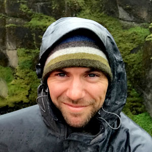 Ryan Meszaros is a botanist and restoration technician with a specialty in taxonomy. He has worked in a wide variety of ecosystems from desert lowlands to alpine tundra. Through his 15 years of experience, he has worked for federal agencies, universities, and as a consultant on private, federal, and military lands in California, Arizona, New Mexico, Colorado, and Nevada. His duties have included floristic inventories, vegetation mapping of National Park units, vegetation inventory and monitoring within National Park units, post-fire restoration research, voucher specimen collection, herbarium specimen preparation and a wide variety plant sampling techniques. In recent years, Ryan’s botanical focus has been on endangered plant surveys, vernal pool inventories, and restoration of endangered species habitat. In addition to his botanical specialization, Ryan also conducts protocol surveys for the federally endangered Quino Checkerspot butterfly (Euphydras editha quino, permit pending). He holds his B.S. in Botany from Humboldt University.
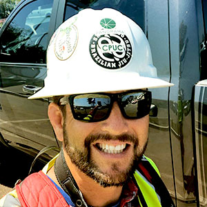 Korey Klutz is a field biologist and project manager with more than 20 years of experience managing and conducting biological services in southern California, Arizona and Nevada. Project management and research experience includes conservation biology, rare plant surveys, sensitive wildlife surveys, and habitat restoration planning. His specialties include Habitat Restoration (County of San Diego Certified Revegetation Planner), botany, habitat conservation, Quino checkerspot butterfly surveys, arroyo toad surveys, invasive plant species inventories, vegetation management plans, and resource management plans.
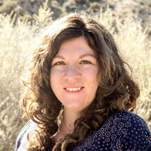 Roxann Merizan is a wildlife biologist who specializes in surveys and monitoring. She has a variety of experiences in monitoring endangered species from reptiles to marine mammals. Her experience also includes bird and botanical surveys, where she has also collected samples for Live Fuel Moisture. Her marine mammal field work has taken her from Southern California, up to the Pacific Northwest, all the way to the Arctic Circle. Roxann has worked on monitoring projects for large oil companies, Southern California Edison, and the United States Navy. She is dedicated to quality data collection and analysis.
 Mr. Palmer is a Geographic Information Systems (GIS) and graphics specialist with 16 years of project experience, including professional coordination with public and private clients, project managers, engineers, and planners to ensure that the data, maps, and graphics produced accurately reflect the needs of the individual project. Experience includes more than 400 land development, resource management, restoration, transportation, education, and recreation projects.
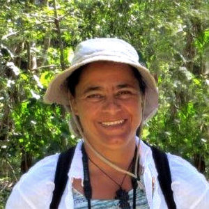 With a bachelors of science in biology and marine biology, Ms. Gutierrez is a highly experienced biologist who has been performing ecological surveys in marine and terrestrial environments in urban contexts and in remote undisturbed biological settings for over 20 years. She has specialized in protocol threatened and endangered species inventories for plants, invertebrates, fish, amphibians, reptiles, birds, and mammals. Ms. Gutierrez has managed and been a key participant in several long-term biological monitoring programs for wetland and native habitat restoration in southern California. She has been involved in all phases of large-scale, multi-use preserve management planning, including restoration design, implementation, monitoring and mitigation bank management for aquatic and terrestrial systems. Her comprehensive background and skill set also includes technical writing capabilities, jurisdictional delineations, SWPPP/BMP implementation, environmental compliance, and regulatory agency experience.
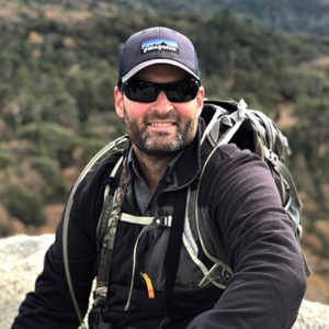 Brian Lohstroh has a unique skill set that combines diverse listed species survey capabilities, and aquatic resource training, with environmental compliance, permitting, monitoring, and constraints analysis. He is a USFWS-permitted biologist and has over 21 years of expertise in southern California ecology. His USFWS permit allows him to conduct presence/absence surveys for Quino checkerspot butterfly, California gnatcatcher, southwestern willow flycatcher, and all California Vernal Pool Branchiopods (fairy shrimp). He is also approved to locate and monitor nests of California gnatcatcher and least Bell’s vireo, and is qualified to handle arroyo toad. Mr. Lohstroh has participated in and managed all aspects of focused wildlife surveys, habitat assessments, construction monitoring and exotic predator control programs. His wide range of experience also includes authoring biological assessments, jurisdictional delineation, habitat restoration, botanical surveys including focused rare plant surveys, vegetation mapping, pitfall trapping, submeter global positioning system, environmental permitting and analysis, and project management. Mr. Lohstroh graduated from the University of California at San Diego in 1997 with a BS in Ecology, Evolution, and Behavior.
 Dr. Baker has worked as a professional botanist for over 40 years; with most of his professional work centered on the autoecology, taxonomy, and distribution of rare plant species; vegetation analysis and mapping, range analyses, and biological assessments. Dr. Baker maintains an academic career that focuses on the evolution and taxonomy of the Cactaceae, primarily Cylindropuntia, and has published numerous journal articles. Dr. Baker has created and maintained two research gardens to study native flora and promote the use of native plants in landscaping. The garden in northern Arizona is primarily for studying cold-hardy plants, primarily cacti, and has over 3,000 accessions. The garden in southern Arizona near Tucson was recently established for the study of frost-sensitive species.
 Dr. Kentner is a botanist specializing in the flora and vegetation communities of California. He has conducted and led botanical surveys for many projects located throughout the state, and has training and experience in vascular plant taxonomy, vegetation classification and mapping, and wetland delineations. He has led the botanical survey efforts for more than ten large-scale renewable energy and infrastructure developments in the Southern California deserts, the Tehachapi Mountains, and the Southern Sierra Nevada Mountains, and has contributed to several large-scale vegetation classification efforts in California. Dr. Kentner is equally comfortable conducting field surveys, designing and implementing GPS / GIS data collection strategies, producing GIS maps, and serving as the primary author of technical reports and permit applications. Dr. Kentner is skilled in environmental document production and technical editing, and has authored or contributed to many types of environmental documents. He obtained a B.S. in Botany from Humboldt State University, an M.A. in Biology from Humboldt State University, and a Ph.D. in Genetics from the University of Georgia.
 Mr. Varner works in applied ecological restoration in the American West. With experience on river and upland restoration projects, he works as a private consultant to design and implement natural resource management and conservation projects. David received a B.S. from Montana State University and worked as a seasonal field biologist before returning to school to study coastal stream restoration at Humboldt State University. Since then, he has worked in a variety of freshwater habitats in the Great Basin and Pacific Northwest, as well as, charitable natural resource conservation projects in South Asia, Mexico, and the American West. David was Director of Resource Management at San Elijo Lagoon Conservancy 2011 – 2015 and has served on the board of California Native Plant Society and as President of the San Diego Chapter. Having worked on a variety of natural resource conservation efforts over the past twenty-plus years, David recognizes the vital contribution that planting and fostering native plants in suitable locations (ideally on protected land!) is toward environmental restoration. His current focus on the intersection of native plant landscaping and wildland restoration informs that strategy.
 Josh Holloway is a wildlife biologist of over 22 years and the principal investigator of Big Creek Co, which focuses on environmental compliance in California and the desert southwest. Josh has experience with renewable energy and linear projects during siting and licensing, pre-construction, construction and operations, with an emphasis on mitigating impacts to federal and state protected species. Writing includes many NEPA and CEQA environmental documents, compliance reports, statistical design and analysis, as well as development of monitoring and survey protocols. Josh is an approved state and federal Designated Biologist and holds several agency permits, including for Mojave desert tortoise. His work includes other desert species such as golden eagle, burrowing owl, desert kit fox, American badger, big-horn sheep, mountain lion, small mammals, and migratory birds. He holds a bachelor’s and master’s degrees in wildlife ecology and worked with many other protected species such as Canada lynx, grey and eastern wolf, and black bear. In addition, Josh has maintained an active U.S. Coast Guard Master’s license for 15 years with over 15,000 hours logged in Southeast Alaskan waters.
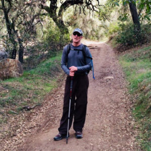 Bill Graham is an environmental planner with almost 35 years of experience in preparing environmental documentation under state and federal regulations. He has experience in both the public and the private sector. Much of Mr. Graham’s career has been spent leading multi-disciplinary teams conducting environmental analysis for large-scale energy, transportation and water infrastructure projects. He is very experienced in preparing NEPA and CEQA documents, as well as overseeing the ancillary permit approvals needed for project implementation. He is experienced in consultations required under both the Endangered Species Act and the National Historic Preservation Act. Mr. Graham has extensive experience in the development of construction monitoring programs and in compiling the documentation necessary to substantiate compliance with permit conditions and mitigation measures, particularly power generation and transmission facilities. He has a broad geographic base of experience both nationwide and across California, which provides insight into the application of environmental regulations in a wide variety of contexts. Mr. Graham is a member and Past President of the California Association of Environmental Professionals (AEP). He obtained a B.A. in Cultural Anthropology and an M.C.P. in Urban and Regional Planning from San Diego State University.
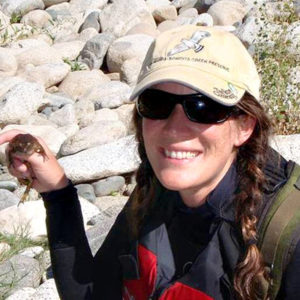 Ms. Scott is a biologist and technical editor with 17 years of experience in the environmental compliance field. She has written or contributed to numerous natural resources and environmental compliance documents including Biological Assessments/Biological Evaluations, Environmental Assessments, Environmental Impact Statements/Environmental Impact Reports, Natural Environment Studies, biological data reports, vegetation management plans, protocol-survey reports, biological constraints analyses, and other technical reports and studies. As a technical editor, she has provided editing, proofreading, and peer review to hundreds of products, from large environmental studies covering a range of disciplines to white papers, presentations, and environmental education materials. Ms. Scott is skilled at reviewing products to ensure that content is accurate, concise and consistent, appropriately presented to the target audience, and adherent to special formats or requirements. Ms. Scott received her B.A. in Environmental Studies from University of California, Santa Cruz in 2002.
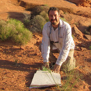 Frankie Coburn is a botanist and ecologist specializing in the flora of the desert southwest and southern California. He has over 15 years of professional experience working for federal agencies, universities, and as a consultant designing and conducting surveys, monitoring projects, population demographic research on federal and state-listed rare plant species, ecological research and restoration, vegetation/habitat mapping, and floristic inventories that have included over 5000 plant species throughout the desert, coastal, mountain, and transition zone ecoregions of the southwestern United States. Frankie has published technical botanical field guides for southwestern US wildlife refuges, composed habitat assessment and rare plant reports for energy projects and federal agencies, and published research papers in plant taxonomy and ecology. As a biological consultant, Frankie utilizes botanical distribution and geologic databases to predict potential occurrence of species of concern in project areas, designs and implements GPS/GIS collection and mapping strategies, performs taxonomic plant identification, employs sampling protocols in accordance with state and federal guidelines, and
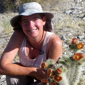 Michelle Cloud-Hughes is a botanist and restoration ecologist specializing in desert flora and ecosystems. She worked for the Soil Ecology and Restoration Group at San Diego State University from 1997 to 2013 and spent most of those years doing restoration work in the central Mojave Desert at Fort Irwin National Training Center. In 2010 she started her company, Desert Solitaire Botany and Ecological Restoration and since then has been involved in multiple rare plant surveys and other botanical and restoration projects throughout the southwestern U.S. and Mexico. Her main research interests are morphometrics and genetics of the Cactaceae, particularly within the genera Cylindropuntia and Grusonia.
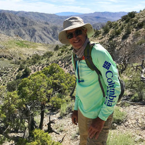 Bob Huttar is a senior field biologist specializing in botanical assessments, tree surveys and restoration projects. He has years of experience performing a wide variety of focused rare plant and other botanical surveys, habitat assessments, tree, avian and wildlife surveys, restoration team and construction monitoring throughout Southern California. Bob has experience with many GIS field monitoring and corporate and municipality reporting systems. He has prepared technical reports and biological resources assessments in accordance with California Environmental Quality Act (CEQA) guidelines, and with Habitat Conservation Plans and Local Plans of southern California. His background includes a comprehensive familiarity with multiple fields of natural sciences, a career in professional medical sales and marketing, greenhouse operations and was a firefighter for the US Forest Service. He is a reliable and resourceful self-starter with a B.A. in Biology/Botany from UC Santa Barbara and an M.B.A. in Marketing from National University.
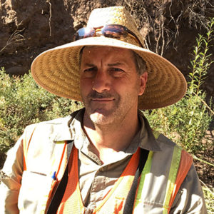 Scott Werner is an ecologist with 24 years of experience working on biological resource studies and consulting projects in California, Arizona, and Texas. Mr. Werner’s area of specialty is in ornithology and wildlife ecology, but he also has expertise in botanical studies, GIS, invasive plant removal and restoration, construction monitoring, and technical writing. Mr. Werner holds state and federal permits authorizing surveying and monitoring of endangered least Bell’s vireo and southwestern willow flycatcher and has substantial experience with other listed and sensitive species such as spotted owl, golden eagle, burrowing owl, desert tortoise, western pond turtle, California gnatcatcher, and yellow-billed cuckoo. He is on the County of Ventura Planning Division’s list of approved consulting biologists and has conducted a wide range of biological assessment studies throughout Southern California for projects ranging from small utility maintenance actions to development projects involving vegetation mapping and biological inventories of large natural areas. Mr. Werner earned a B.S. in Ecology and Evolution from U.C. Santa Barbara and an M.S. in Wildlife and Fisheries Sciences from Texas A&M University.
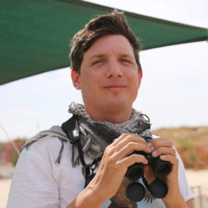 Luke Tiller is an internationally recognized expert on raptors and raptor migration with over ten seasons running and consulting on raptor monitoring projects both here in the U.S. as well as Europe, The Middle East, and Asia. He has given presentations at conferences and birding festivals across North America as well as in South America and Europe, and written extensively for sector press on these topics.
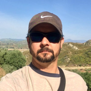 Ron Francis, Jr. has over 19 years of environmental consulting experience throughout Southern California. He holds a 10(a)(1)(A) USFWS permit to conduct presence/absence surveys for the Coastal California Gnatcatcher, and specializes in other avian species including Least Bell’s Vireo and Burrowing Owl. Mr. Francis also has experience in Brown-headed Cowbird trapping and has attended the Southwestern Willow Flycatcher-Sierra Research Station workshop and training. He is adept at conducting arroyo toad, western pond turtle, and western spadefoot surveys in addition to his avian experience, and he also has experience with small mammals, such as kangaroo rat and wood rat. In addition to his expansive wildlife repertoire, Mr. Francis is well versed in environmental compliance, where he has worked on many aspects of large-scale utility projects, including surveys, reporting, and construction monitoring. Mr. Francis graduated from Cal State Northridge in 2001 with a BS in Environmental Biology.